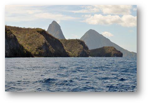
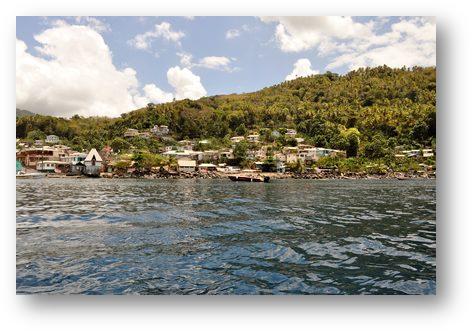
Soufriere; St Lucia
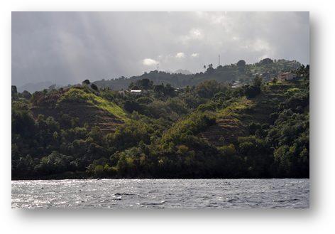
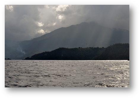
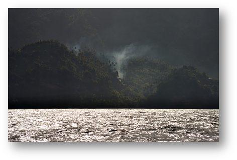
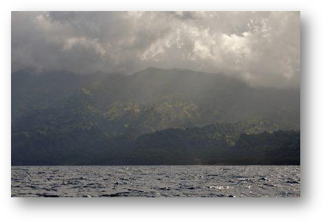
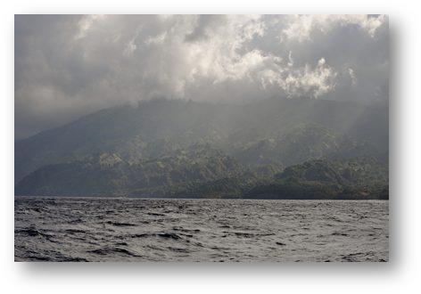
Position: 13:50.958N 61:03.744W Date: Tuesday 12th March 2013 We left Wallilabou at about 8:00am on Tuesday morning and set off for St Lucia, the next island north of St Vincent. The sailing guide book says that the wind around the north coast of St Vincent can be strong and the seas rough. Both predictions were correct. The northern end of St Vincent is high with the volcano of Soufriere rising to around 3,000 feet. (The name Soufriere occurs quite frequently for different places on different islands in the area). The coastline was moody and magnificent with extensive cloud cover over the island and the occasional burst of sunshine highlighting the amazing textures of the forested slopes.
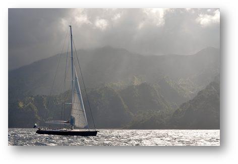
At one stage we crossed tracks with a super yacht called ‘Whisper’ running downwind under staysail alone.
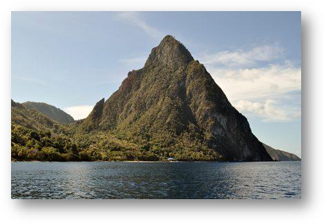
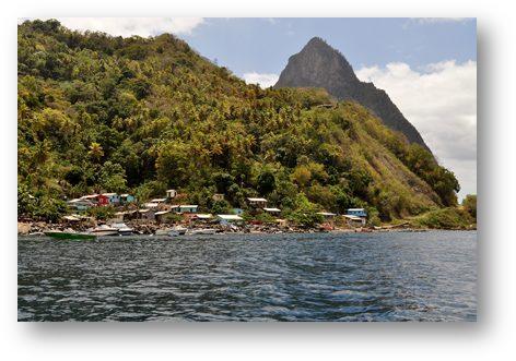
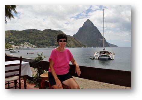
As we rounded the top of the island we started to ship large quantities of water over the bow. At one stage this overcame the capacity of the dorade vents to cope and about a gallon of seawater worked its way through the coach roof. This was the first time that this had happened to me in the last 14 years of extensive sailing. Hallberg Rassy in their wisdom had placed the dorade vent over the chart table, so the sea water entered in one of the most sensitive parts of the boat where there are numerous electronic components and paper charts that don’t respond well to being soaked. Fortunately no instruments were damaged and I was able to mop up the water in the chart table before too much harm had been done. About half way between St Vincent and St Lucia a couple of pilot whales, swimming southwards, surfaced less than a boat length away from us on our port side. I couldn’t help thinking of our friends on the yacht Ruffian, who hit one of these beasts on their way across the Atlantic. It didn’t do their boat any good at all. As we approached St Lucia the stunning site of The Pitons gradually dominated the landscape. They are one of the most photographed features in the Eastern Caribbean, and we wasted no time adding to the worlds collection of them.
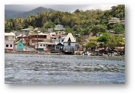
We headed for the town of Soufriere (it’s that name again) which lies within the area of the Pitons National Park. Anchoring is not allowed in this area so we used the services of one of the numerous boat boys to tie up to a mooring buoy.
This manoeuvre is pretty straightforward and is something we have done everywhere except the Caribbean without any external assistance. However here the boat boys see where you are heading, go to the buoy before you, pick up the mooring line and just sit there holding it so that you have to pick it up from them. They then demand their fee! At the same time, before you are even tied up several vendors of unwanted goods hover around the boat, some of them no more than children paddling dilapidated surf boards all vying for your attention and running the serious risk of being hit by a moving boat. I went ashore to do the usual customs formalities. I had to dodge the usual posse of youngsters all competing to be my appointed ‘dinghy guard’. Afterwards I took a short stroll through the town, which had some fascinating old buildings to see. I received a certain amount of attention from the locals, but of the kind that discouraged me from putting my camera on public display, so no pictures of the town I’m afraid. |