Oriental, North Carolina
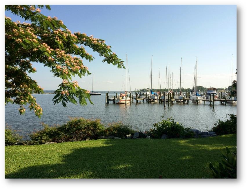
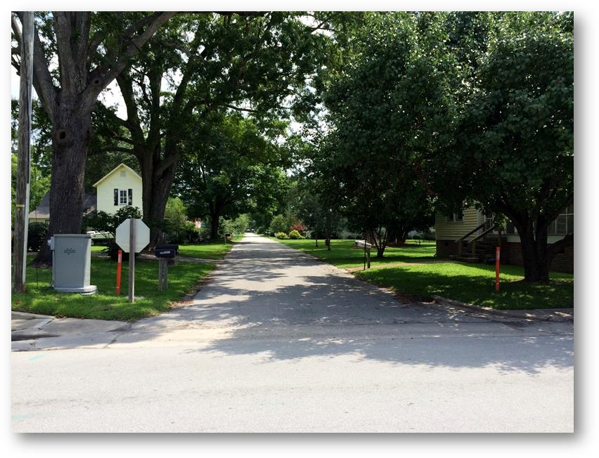
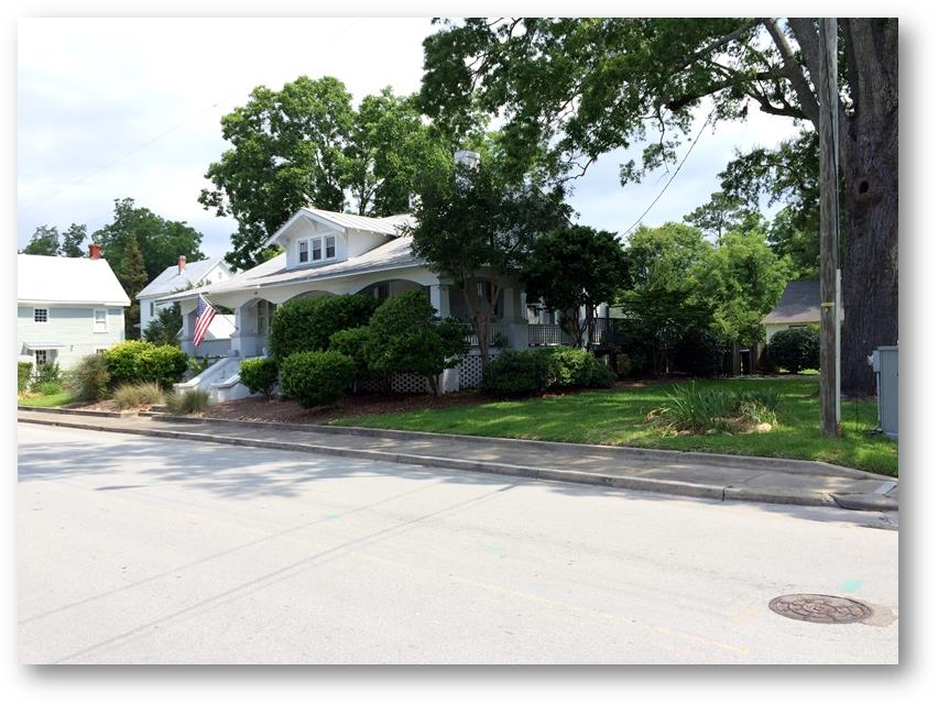
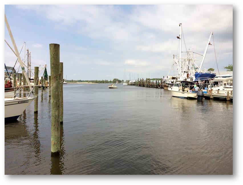
Date: Sunday 15th June 2014 Position: 35:01.361N 76:41.938W I left Beaufort on Saturday 14th June along the next leg of my trip that would take me through the Intra Coastal Waterway (ICW). The alternate route would have required me to sail more than a couple of hundred miles around the outside of Cape Hatteras. If it were at all possible I would have preferred to have taken this outside route, but it would have required me to have spent at least a couple of days at sea, which would have been too much for me to do whilst sailing solo. It’s also an area that is shallow, has no ports of refuge and has a bad reputation for sudden unpredicted storms. The ICW winds its way through various rivers and canals and although its waters are tranquil and picturesque it does have its own unique set of problems. For my boat in particular these are principally characterised by its lack of depth and the height of its bridges. The main channel from Beaufort northwards is stated to be deep enough, but I will have to stop somewhere along the way to sleep and there are precious few places outside the main channel that have sufficient depth for me to enter without running aground. Anchoring in the main channel is, of course, forbidden. Additionally the height of my mast, with antennas, is very close to 64 feet, and at least one bridge along the way is stated to have a clearance of only 64 feet. Although tides do not have much effect on the water height, southerly winds can cause water levels to rise, and the predicted winds during the duration of my trip are likely to be from this direction. Fortunately I have my own dedicated pathfinders. Tim & Aoife have gone ahead of me and as they have passed along they have relayed back to me information about what they have found, in particular shallow spots and bridge heights. This information is invaluable and has given me the confidence to press on when I might otherwise have wasted time worrying about what may lie ahead. The first part of the trip took me past Moorhead City and through the first fixed bridge at the entrance to The Newport River. A sail boat passed through ahead but coming towards me so I called him on the VHF to ask him his mast height. Another boat must have heard my request, because when I passed through a few minutes later (the markers by the bridge declared an air draft of 66 feet) someone called me up to say that they had been watching my transit through their binoculars and had estimated that there was about 2 feet clearance above my antennas. This kind of verified what I believed my mast height to be and also gave me some confidence that the markers that specified the bridge heights were reliable. After the bridge The Newport River opened up into a wide expanse. I knew that there was only a narrow channel through this area but I found it quite confusing trying to decide exactly where it was. The clear simple lines on the chart, in the real world collapsed into a confusion of parallax, perspective, false markers and very bright reflected sun light. This is when I learnt another important couple of lessons about negotiating the ICW a) follow the channel marker buoys attentively one at a time and b) the buoys are actually positioned outside of the main channel (the channel lies between them). Apart from a couple of anxious moments where depths were considerably less than what they should have been the rest of the journey passed without incident. Newport River gave way to Adams Creek Canal and then Adams Creek itself, which in turn opened up into The Neuse River. After the narrow confines of the canal the river suddenly seemed massively wide with its far shore being so far away that it could not be seen very clearly. My intended destination, the town of Oriental, lay on the other side. The colour of the water was very similar to that which I had found in Georgetown a week or so ago, namely dark brown but turning to a burnt orange when the light caught the bow wave. It took about an hour to cross the river, negotiate the shallow channel into Oriental and find somewhere to anchor for the night. As expected the small harbour was shallow, but I was able to find a suitable spot right at the outside of the harbour. There was very little wind so everything was calm. As a pattern that had repeated itself several times already, Waimangu had arrived a day or so before me and were moored alongside one of the pontoons inside the harbour. I went ashore in the dinghy to meet them, and immediately retired to a bar just a few feet away to have a beer or three and watch one of the World Cup football matches (can’t remember which one). Whilst I had been in Nassau (Bahamas) I had met a guy on the dock (Tim) who lives in Oriental and he had given me his contact details. We met up on Sunday for a coffee and he took me for a short drive around the town. Later I walked around for a couple of hours looking at the local views. It was another charming Carolina town that looked like a wonderful place to live. But I could only really think about the rest of the ICW that was to come and was not able to fully appreciate what it had to offer. The difference between British and American English has often been commented upon. I saw the following sign in the toilets of a local bar, which is rather confusing to an Englishman. |