Passage to Kalili Harbour, New Ireland.
Lochmarin
Tue 13 Sep 2016 08:13
03:26.104s 151:55.679e 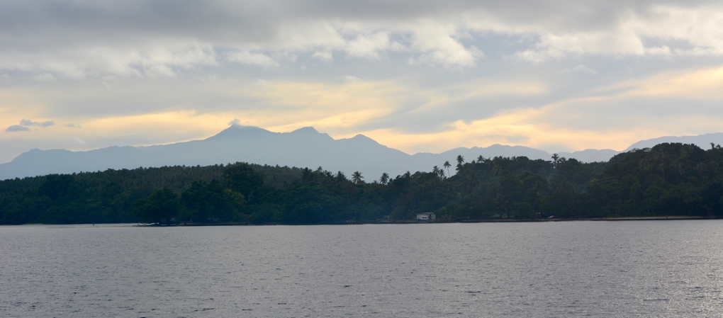 The mountains of our next destination, New Ireland, rising behind Mualim, Duke of Yorks, as we approached the pass. 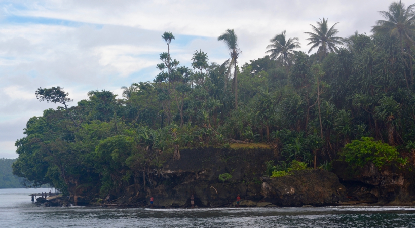 Fishermen watching us sail through the pass. There was plenty of wind so we had a good day’s run sailing along as a cutter because we left the mizzen awning up as a shade against the sun. The weather grib file had predicted heavy showers continuing during the day but we managed to dodge them so the awning was very welcome in the fierce equatorial sun. We hooked another marlin on the way, this one broke the line, taking hundreds of feet and a good lure with him. Marlin are all very exciting but give me a nice catchable mahi mahi any day!  The 5000ft mountains of New Ireland. As we followed along the coast of New Ireland we started to realise quite how high the mountains were. They rose up to in steep steps to a high plateaux of around 5000 ft, about 3 miles inland, and all were covered in dense rainforest. Magical. Phil had spotted what looked like a nice little anchorage on the chart for us to stop in overnight. He’d downloaded the satellite images too whilst we had internet in Kokopo so we had a good idea of where the reefs were, although we were hopeful as our chart showed it well surveyed. 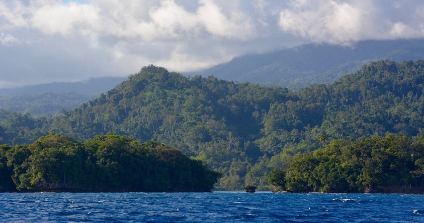 Our destination, Kalili harbour, is just behind the two islands in the foreground - you can see the strip of light blue calm water in the gap. When we got there we found it was a good job we had the satellite image to work off - the chart was a good couple of miles out! All the same, although it wasn’t too bad coming through the narrow channel between the overlapping reefs, it was quite difficult to find a good anchoring spot as the sat image shows the reefs but otherwise doesn’t show you the depths. After a couple of tries we got ourselves nicely settled just in front of the village and just before the sun went down.  Looking West in Kalili Harbour, the usual evening thunderclouds are on the way.. The village folk had waved and called to greet us whilst we anchored and we could see them gathered in the clearing by the sea. Another Island, another community, another, slightly different, way of life. We were looking forwards to meeting them the next day.  |