St Helena 15º 55'S 05º 34'W

|
St Helena is probably best known as Napoleon's prison island and the place where he died.
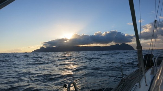
Lying approximately 1010 miles from Angola and 1910 miles from Brazil, it is a small island sitting on the line of the mid Atlantic ridge with Gough Island and Tristan da Cunha to the south and Ascension Island, The Cape Verdes and the Azores to the North West. St Helena is a British island territory along with Tristan and Ascension and is the administrative capital for all three. Like these two other islands St Helena is so small that it is represented by little more than a full stop in the average atlas but it has a 500 year history and a number of very famous people as well as Napoleon have been here including the Duke of Wellington, Captain Bligh, Captain James Cook, Edmund Halley and Charles Darwin.
The island's early history was dominated by the war lords of the sea. First discovered accidentally by the Portuguese commander Joao da Nova in 1502 whilst sailing the return route from India around the Cape, it was named St Helena in honour of the Emperor Constantine's mother. The Portuguese, keeping their discovery a secret, used the island to advantage for their ships to load fresh water and other provisions and soon development started, goats were introduced, which in the longer term destroyed much of the endemic plant life creating a control problem for future generations. The English wrested the island from the Portuguese and destroyed their chapel. In the mid 17th century it was annexed by the English East India Company which built a castle and commissioned a Captain Dutton to settle and develop the island. In 1672 the rival Dutch seized the island only to have it recaptured by the English the following year. The population then was around 700 souls comprising of soldiers, slaves, Huguenot refugees and some who were victims of the great fire of London as well as others who washed up here during this swashbuckling period.
With a population now around the 5,000 mark, the island has few ships other than cruise ships stopping and imports most of its food and other goods from South Africa via the RMS St Helena which does a monthly round from Cape Town to St Helena and Ascension Island. Nevertheless, it provides a a reasonable provisioning place and a pleasurable stop for yachts heading north and this traffic is increasing as yachts are no longer able to transit the Red Sea and Suez Canal due to Somali piracy. It has been an excellent stop for Gryphon II, providing us with diesel, gas, water and a limited amount of fresh food. The weather has been kind (it can be extremely swelly here as there is no real harbour) so the substantial mooring has provided the opportunity for a much appreciated rest with time to enjoy the island and its Georgian seaport.
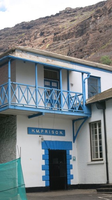
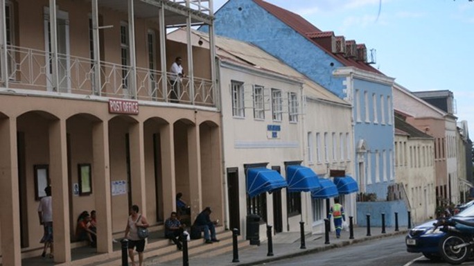
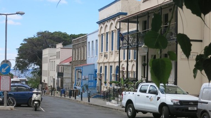
The people here are extremely friendly, polite and obliging. Everyone gives a greeting when passing in the street or waves to passing cars and driving etiquette is excellent. Such a pleasure. Jamestown feels extremely English and is said to have more listed Georgian buildings than any town in the UK albeit with their Victorian embellishments. From the water front the town is entered through an archway carrying the East India Company Coat of Arms and opening out onto the town square with its castle, now the administrative centre of Government and Council. Close by are the library, said to be the oldest in the southern hemisphere, the Police Station and the tiny prison built in 1827 and probably looking much as it did then.
Further on is the oldest Anglican Church in the southern hemisphere which dates from 1772 and many more lovely buildings that line Main Street as it rises gently up the hill.
The Consulate Hotel (mid-18th century) now has railway girders supporting its ornate courtyard verandah and a dining room that has the remnants of ships masts as the main supports. Nothing wasted here!
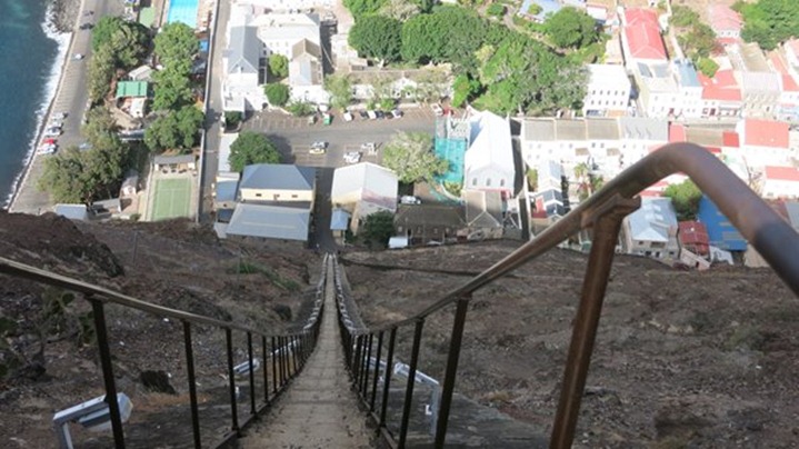
Jacob's ladder looms above the town, Built in 1829 this was built for hauling manure up to the flatter farming areas and lowering produce and other goods down. An impressive relic of the past but fascinating to visitors who pit themselves against its 699 steps and 600 ft. rise to the top of Ladder Hill and are presented with a certificate to prove it. They deserve it.
Getting ashore to enjoy this island is one of the things that worried us prior to arrival. The harbour is really an open road-stead which can be a mountain of rollers if the swell sets in from the north and getting ashore at the quay becomes a dangerous business which we have read much about. We have been so fortunate as although it might have been good to have stronger winds for our passage from Namibia, we weren't challenged by bad weather and at St Helena it is peaceful and we can get ashore safely. We don't even have to blow up our dinghy because there is a harbour ferry, ostensibly for local working boats but extended to support visiting yachts, which is a real treat.
The harbour ferry, our water taxi.
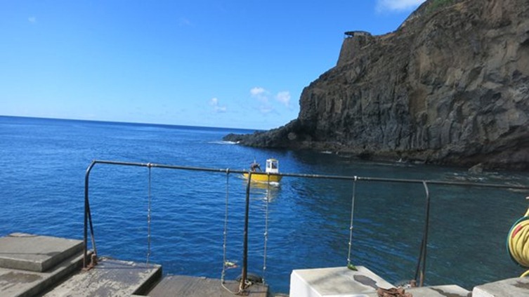
The quay has several levels to accommodate embarking and disembarking at different states of the tide, this is low tide, the whole thing is often awash at high tide. The framework has knotted ropes hanging down at the edge of the quay and when the swell comes, lifting and dropping the ferry as it does at high tide, then one must hang on tight and swing ashore as it lifts. Our first sojourn ashore enabled us to see the town, visit the helpful tourist office, find out how to get gas and diesel and happily to book a car so that we can see more of this interesting island.
|
