Ascension Island to the Azores Day 9 – Hazards of the course

Caduceus
Martin and Elizabeth Bevan
Tue 28 Feb 2017 04:12
|
Position
05:52.27 N 026:43.70 W
Date
2359 (UTC) Monday 27 February 2017
Distance run in 24hrs
135nm over the ground, 133nm through the water
Passage total 1,141nm over the
ground, 1,075nm through the water
Distance to go 2,484nm
Planned distance Ascension to the Azores west around the high
3,666nm
(Yesterday's entry for longitude should have read 025:32.18W and not
026:32.18W. I will re-post the entry)
Today's excitement was shipping. The early hours of the morning saw
us crossing what must be a route from and to the east coast of South America
with destinations of Rio in one direction and everything from Las Palmas and
Tangier to the Mediterranean in the other. Nothing came within 30nm of us
but it added interest. Due to some sort of atmospheric anomaly we went for
three hours picking up AIS targets as far away as 995nm to the west in places
like Gambia, Senegal and Guinea; these were identifiable by name and reported
position; we did not try and call them. The day saw strengthening winds
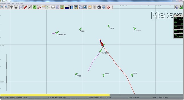
and a new hazard. We passed through a total of 3 rows of 3 AIS objects
which must have been markers of some sort. We came within a mile and a
half of one and saw nothing. There was also a mother ship off to the
west collocated with a tenth marker. To add to the fun the 235 metre
tanker Oratorio decided to share our bit of ocean. The Oratorio was very decent
and altered course to go 2 miles behind us. We ploughed on through the
area of the buoys, as did the commercial shipping, assuming, and hoping, that
the buoys were not joined together by nets.
A busy AIS plot as shown on our OpenCPN display
|
