Dolhiyadhoo - ghost cities of the Maldives
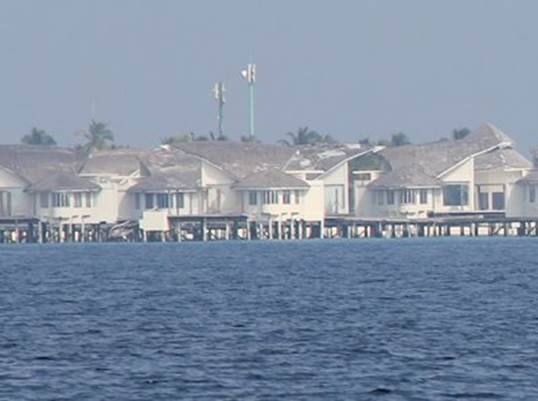
Position 05:59.526 N 073:13.328 E Date 1625 (UTC+5) Wednesday 9 March 2016 Distance run 40.3nm over the ground A quick expedition to the nearest shop to stock up on some fruit and vege’ was followed by a departure only a little after Flomaida for a day spent mainly motoring but with a little sail assistance. Our course took us just east of south down the middle of the largest of the northern group of atolls. The chart is an approximation and downloaded Google Earth overlays are very useful. Given the good mobile phone coverage using Google Earth live is also very reassuring as we can view it on an iPad in the cockpit. A minor complication is spotting what are clouds and what are shallow patches, on Google Earth that is, even we can tell the difference on the ground. Next time Google please take your photographs on a cloudless day. We were aiming at the abandoned resort construction at Dolhiyadhoo. It seemed that it was not on its own as the resort islands that we passed all seemed abandoned.
Vagaru -what appears to be a completed resort complex with no sign of ever being occupied and now gradually falling to bits Various stories filter through the cruiser community, often representative of a sea borne version of Chinese Whispers. The essence is that Dolhiyadhoo was abandoned about three years ago some 3-6months short of completion. Subsequent attempts to sell it on have failed an it is now falling into disrepair. We anchored at 1630 with still enough light to see the bommies. The next diary entry will give the position that we moved to, closer in and with better light to see what we were avoiding and our four day stay. |