MI Forts Walk Pt 1

|
The Forts Walk on Magnetic Island – Part
One
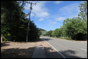
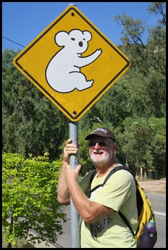
Ashore again after the heavy rain overnight, the sun was out and it was a gorgeous day. We immediately saw some pretty flowers and were surprised to see such a main road, the island is much bigger than we had first thought. Soon we were bimbling along, heading up the hill to the Forts car park where the track proper would begin, but first, a koala bear sign that only Bear could pose by, anyone else would not have seemed proper.
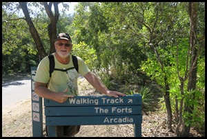
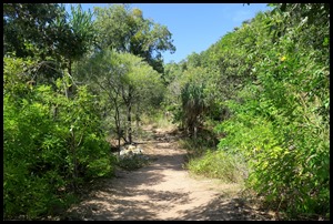
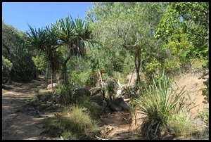
After fifteen minutes or so we saw a walking track sign, the rough path took us past a creek bed and up the steep hill beside the main road.
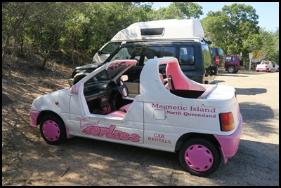
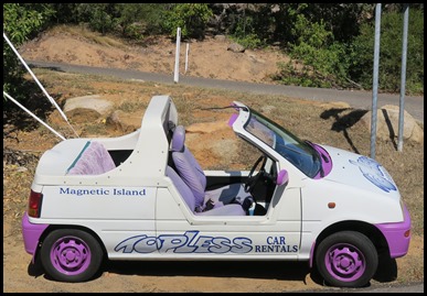
We popped out at the top of the track, crossed the road to the car park and met these fun Topless ladies.
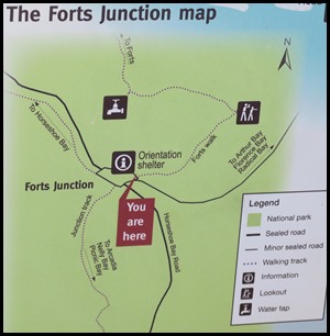
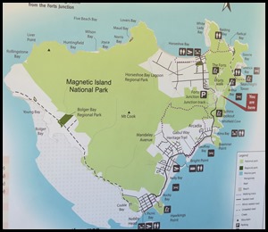
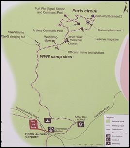
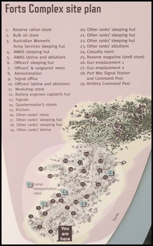
We stopped at the information boards, always like the ‘You are here’. The island – the greater part of which is National Park and the Forts map.
The Walk: The remains of The Magnetic Battery form part of the popular 3.8 kilometres (2.4 mi) environmental and heritage trail, The Forts Walk. The walking trail begins at the turnoff of the road to Radical, Florence and Arthur Bays from Horseshoe Bay Road and winds through the hinterland following the approximate route the original track to the battery followed. The track provides excellent views over Arthur and Florence bays and native wildlife can often be seen alongside the track. Queensland Parks and Wildlife Service maintains the track and fortifications and has provided safe staircases to allow near-unrestricted access to the Command Post and Observation Post. It is important to note that the Command Post building is still an operational radio-repeater and navigational beacon, as such part of the second story of the building has been bricked off to house generators and radio equipment. The walking trail is a popular tourist activity and Magnetic Island Bus Service provides a regular bus service to the entrance to the trail.
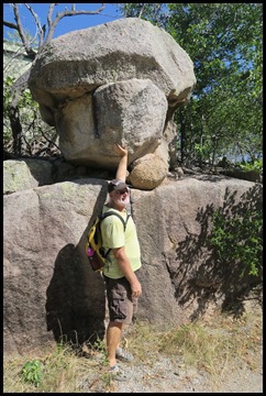
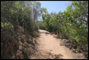
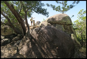
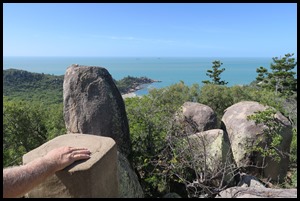
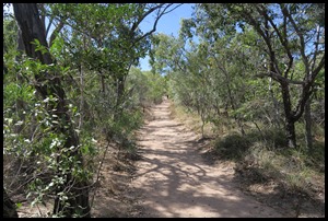
First stop was Arthur Lookout. The rocks are huge and although they look precariously balanced are solidly seated. The well maintained track.
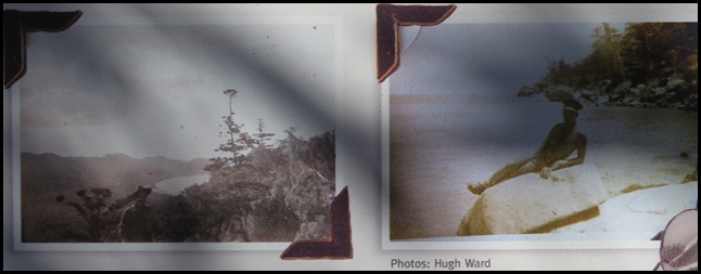
“We had to blast our way up to the top of the hill, drilling by hand to place the gelignite and blowing the rocks to pieces. It was slow progress”. Hugh Ward 2014 (Site Engineer 158 CASL Section, 1942). Back in 1942, it took a lot of muscle power, jack-hammers, explosives and a D8 Cat dozer to carve this two kilometre track through the rugged landscape. A small unit of army engineers, headed by Lieutenant Hugh Ward, led the way. From June to December they surveyed and blasted a route to the top, making way for construction of the track, campsite and fortifications by a local crew from the Main Roads Commission. Torrential rain that wet season washed out sections of the new road, requiring early repair work. The storms also upset the unit’s Christmas celebrations, soaking the spit-roast wild pig. Subsequent wet seasons have left their mark on the track. In 2013 the Queensland Government undertook substantial rockwork and repairs to the road to improve drainage and access.
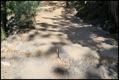 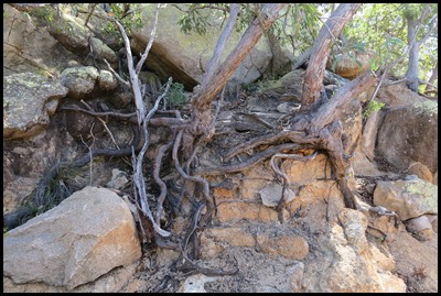
The bumps along they track are called ‘whoa-boys’, they were built to divert water off the road, and the rock capping resists erosion in seasonal downpours. There is a mix of old and new rockwork along the way showing signs of master craftsmen working over seventy years apart... We did indeed stop to admire the whoa-boys and also the incredible way these trees clung to the rocks, roots exposed.
The site.
The Magnetic Battery, Fort War or The Forts, as it is commonly referred, is a former Royal Australian Navy artillery battery in the hinterland of Horseshoe. Arthur Bays on Magnetic Island. Built in 1942/1943, the battery operated from July 1943 until the end of World War II. The remains of the facility are now maintained by Queensland Parks and Wildlife Service as part of the Magnetic Island National Park and are open to visitors year round. During its operation the battery consisted of a two searchlights in Horseshoe and Florence Bays, a radar screen in the hinterland of Arthur Bay, a permanent living encampment and a Command Post, Observation Post and two Gun Emplacements overlooking Cleveland Bay. While the majority of the buildings no longer remain, the fortified concrete command post, observation post, munitions bunker and gun emplacements still remain along with the foundations of many of the buildings within the living encampment. These remains form part of the Queensland Parks and Wildlife Service's The Forts Walk, a popular 3.8 km environmental and heritage walk for visitors to Magnetic Island. The first battery personnel arrived on-site from training at Fort Lytton in southern Queensland in late 1942. They were housed in tents before the huts were completed in March the following year. The water pump and sewage system came later, the power provided by five petrol generators on the site. Living under canvas during a record wet season, few home comforts and the threat of a Japanese attack must have been really tough.
   We followed the
track until we began to see arrows pointing off to each side, we missed
the women’s ablution arrow for some reason, so the first off shoot we took was
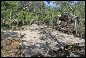
to the flat concrete base that was once the officer’s
latrine and ablution block. “The standing order of the day was for
all men to take a swim at Alma Bay because we had no water”. – CO Major
Arnold Nicolle.
Even the officers experienced some
‘ablution hardships’ before running water and sewerage were organised here.
Water was first pumped up to the camp from Horseshoe Bay in June 1943 but it was
another year before the extensive sewerage system was built. While conditions
were basic. the officers most likely washed in cubicles and had individual or
twin-share sleeping quarters, small luxuries compared with communal living of
the other ranks.
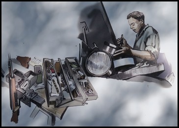
The clang of a shifting spanner and the
whine of a grinder were everyday sounds here in the camp
workshop, where machinery was maintained, vehicles fixed and guns and
equipment serviced. In a typical scene a pair of army mechanics jack up one of
the two battery jeeps, others peer under the bonnet of the truck. An artillery
man in the background pulls a 303 rifle apart.
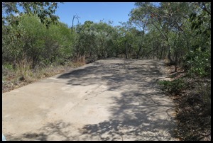
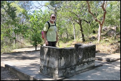
  The large concrete pad gives an indication
of the significance of the building, which included a store for all the supplies
required for daily operations and contingencies. Camp supplies and food rations
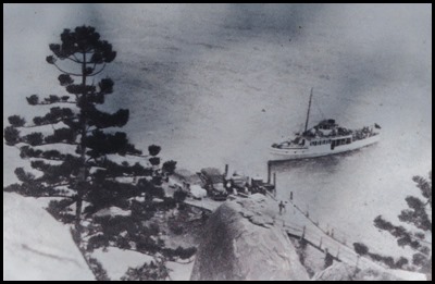
were transported regularly from Townsville to the island on the Hayles’ ferry Malita. It was hard work offloading supplies, particularly the 44-gallon
drums of fuel for the V8 Ford flathead 25 kVa generators that powered the camp
fortifications.
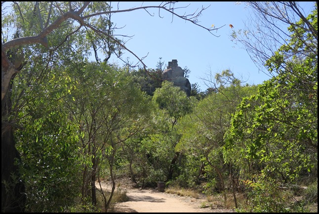 We looked up and saw the command post high above us.
 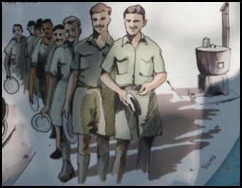 In 1943, the year the
forts’ kitchen began operations, the Australian Army Catering Corps
(AACC) was established to raise the standard of cooking and kitchen equipment
and improve the quality of soldiers’ rations. Better training helped raise the
status of the cooks. Wartime meals provided a welcome break in the daily routine
of drills, shipping observations and signals. At their nearby mess, the men and women lined up for tucker with tin plates and
pannikins, taking their turn at washing up after the meal. Down at the officers’
mess, seated sergeants were served different meals on china plates. “I had
to get up early in the morning to light the fire, cook the porridge and receive
the daily rations from Townsville. You’d finish one meal and get started on the
next”. Andy Zell, local wartime camp cook.
Along the track we saw signs of concrete
pads where the water tanks sat, and the remains of brackets and supports for the
5 centimetre pipes that carried the water up from Horseshoe Bay. It took some
hunting to find fresh water for the camp but by mid-1943 a good supply of water
was being pumped uphill to the header tanks from a well in Swenson’s farm in the
bay.
Despite the island’s dry appearance, water
can be found for much of the year in upland rock pools, remnant wetlands and
wells made by the Wulgurukaba people who knew where water could be found on the
island and used this knowledge for their survival. It wasn’t easy for the early
track layers though, “We used a water diviner to find water and thought we
had a spot at the end of Horseshoe Bay. We spent some time blasting into the
gully and struck water at 25 feet but it turned out to be salty”. Hugh Ward
2014 (Site Engineer in 1942).
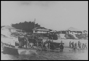   Hauling the Guns:
Critical to the forts’ operation were the two US-Army 155mm guns sited at the
gun emplacements, each weighing over 10 tonnes. It was a massive task getting
them in place in 1942.
Under secure guard the guns were offloaded from US Army landing barges, onto
Townsville beach, for transfer to their destinations, towed across by the steam
tug Albert. The tug’s skipper’s young son John Hall was onboard.
Seventy years on, as an 84-year-old, he recalled: “It was pretty bouncy out
in the bay that day so we went round via West Point and into Horseshoe Bay. The
crew hung sacks soaked in oil over the back of the tug to smooth the
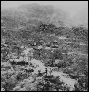
water”. Slick work. The camp from above.
The weighty gun pallets were hauled up the beach over logs, and on their journey
up this track towed behind a tractor, with a tense moment when one gun tipped
over on a bend ahead and had to be righted.
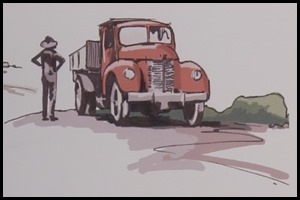
Building materials came by barge from the
mainland to Arcadia, and were loaded onto the ‘Red
Terror’, a V8 truck more often used to cart pineapples. In Geoffrey Bay,
granite boulders were rolled downhill to a mobile crusher that reduced the rocks
to road gravel. “I was employed as a carpenter but in fact I did everything
– tractor driving, steel bending, rock crushing...... even a stint on the
bulldozer but it was a bit nerve wracking for me”. Stan Parsons. Amazing to
think this track was laid in ten months by twenty five men, completing it on the
10th of July 1943.
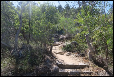 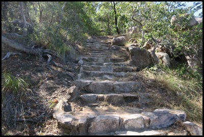 The next part of the
track took us up steps to the Forts Circuit
and to the towers.
History: In 1942 Townsville became an important base in Australia for troops from Australia and the United States. Cleveland Bay, between Magnetic Island and Townsville, also became an important assembly point for supplies and military boats alike, with the bay was providing temporary anchorage for up to 40 vessels assembling for convoys. To ensure the assembling fleets were able to be coordinated and safe from enemy attack, a large military facility, The Magnetic Battery was built on Magnetic Island. Construction began on the 28th of September 1942, and the facility was built to a plan of a standard Most construction materials for the facilities were shipped to Arcadia by lighters or Hayles Ferry Service and transported up to the battery by road. The guns and materials for the Horseshoe Bay searchlight were shipped to Horseshoe Bay. The fortified structures were constructed of 12-inch-thick (300 mm) reinforced concrete poured into custom made forms on-site The facility was completed on the 10th of April 1943 and promptly began operation under the Australian Royal Navy. The radar screen in Arthur Bay was operated by the 13th Australian Radar Unit. Battery Commander Major Nichol commanded the artillery detachment of over 100 people responsible for the Magnetic Battery.
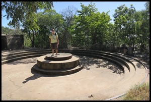 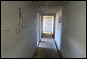 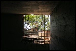 The two guns located at the Magnetic Battery, originally bound for Manila, were diverted to Magnetic Island by General McArthur along with a number of other guns that were requisitioned for use in Australian coastal batteries. The guns were based on the French Canon de 155mm GPF and had a set of rubber tyres at the front of the gun that allowed it to be easily towed by a tractor. These were positioned at Magnetic Battery each on a concrete Panama mount with a full outer ring of metal rail set into the concrete base allowing the guns a full 360-degree traverse. With a 26-foot (7.9 m) barrel the 155 mm gun could fire a 105-pound (48 kg) shell up to 18,000 yards (16,000 m) with a 6-foot (1.8 m) recoil.
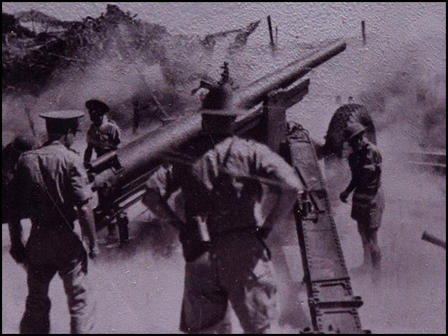
The guns were removed following the war but are one of the most controversial issues surrounding the history of Magnetic Battery. It is often contested whether either of the guns ever fired a shot. It is well known that the guns never fired on an enemy vessel; however, it is believed, although not confirmed, that the gun facing the harbour entrance did fire on an U.S. Navy PT boat "in mild astonishment" when it "arrived unannounced". It is also considered that four guns were deployed for emplacement at Magnetic Island during the war. However, in early 1999 a letter to the Townsville Bulletin from an Eric Hall claimed that his father, being the tug master of Townsville Port at the time, towed only two guns aboard a barge to Magnetic Island. The two searchlights were manufactured by the
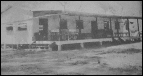
Following the cease of hostilities in 1946 the battery was decommissioned. The guns used at the facility were disassembled, removed and shipped to Southern Queensland while construction materials from the demolished buildings as well as a large amount of remaining equipment, machinery and plumbing were auctioned to local residents. The building above was photographed just after being re-sited in Arcadia. It is now a comfortable holiday home with little sign of its military past.
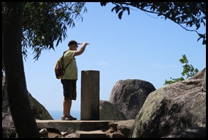
The rangefinder and view.
Continued |

