Sunday 17th August - Walking on the Hornstrandir and Leirufjorðu r

Awelina of Sweden
James Collier
Sun 17 Aug 2014 15:48
|
66:13.77 N, 22:34.96 W
The wind died away to almost nothing but still from the NE overnight but is
forecast to turn around and come from the SW during the afternoon. The kedge
anchor, (a Fortress with a short length of chain + 20mm nylon 8 plait rope laid
in a ‘Bahamian moor’ for those anchor aficionado's amongst you) was laid out to
the SW by James and Peter as insurance against the wind getting up while ashore
on our planned walk. Breakfast and getting ready always seems to take longer
that it should however we were ready with rucksacks, lunch and outboard on the
dinghy by half past ten.
The area we had chosen for our walk was among the remote hills to the
Northeast of Lonafjordur. The base of the valley as we wet out was green and
verdant - and quite wet. Tiny mare’s tail plants grow here amongst grasses,
heathers and wild angelica, with tufts of cotton grass (we think) and those were
just the ones we thought we could identify.
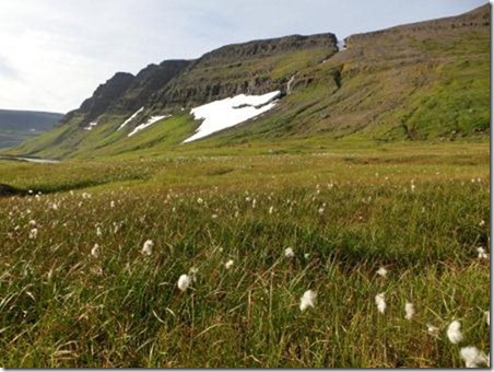 This lush growth gradually got sparser and shorter and gave way to lichen
and moss and dwarf heathers as we ascended up the corrie below the shoulder of
the Breiðaskarðshnukur(1) summit.
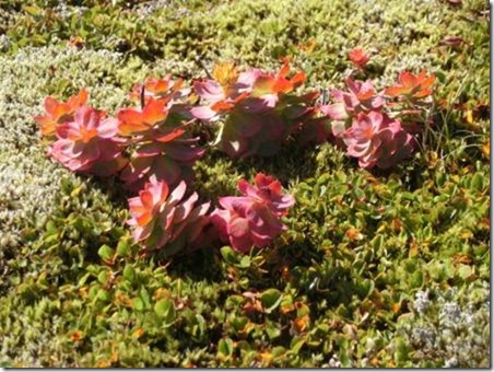 Tiny plants growing further up the hillside.
Looking above us we could see the large patches of unmelted snow clinging
to the steep hillsides below the nearly vertical cliffs at the valley head. Our
walk took us up the side of several of these substantial patches of snow and the
emergent waterfalls (of which there were many). We had been told a few weeks ago
that this year has been colder on the Hornstrandir than most and that more snow
remained despite it being August. It certainly felt warm to be walking uphill in
the brilliant sunshine across snow. (Note that we only walked across those
patches we considered to be “safe”. At this time of year the snow is
rotten and there are many hidden rivers and gorges underneath these patches that
we could have fallen through).
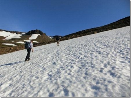 Carefully crossing snow.
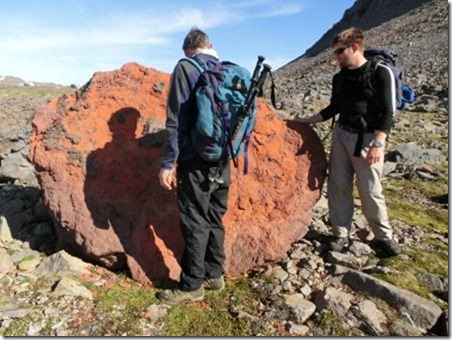
Some unusual rocks took our fancy, bright red in total contrast to the
blackness of the other rocks and the brilliant white of the snow.
 On reaching the shoulder of the hill almost level with the pass across to
the next valley we spotted the boat below us, tiny and reflected in almost
perfectly still water.
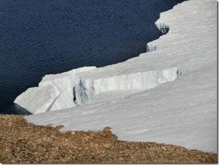
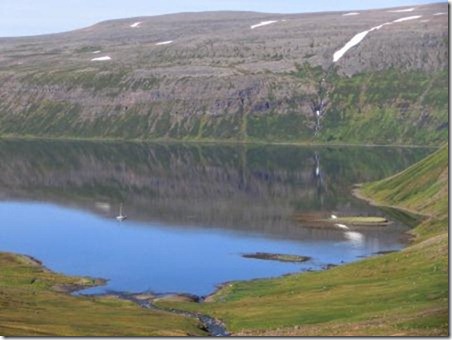 At the mountain lake, marked þrengslavath on our map, the unmelted ice
extended into the water and appeared almost as a small glacier. (There was a
huge glacier to our south at the top of the next fjord; this is glacier
country).
 The views to the north and east were impressive – right the way down to the
coast and beyond, we think to the next peninsular of northern Iceland. The wind
had stared to pick up at this point and we tucked ourselves out of its way to
eat lunch. This country appears vast and unspoilt – which after all is why we
came. The light is sharp and clear and in today’s conditions we could see for
miles. We tried to see if we could see the curvature of the earth – James
thought you could using the side of the map as a ruler – which indicates the
clarity and distance we were able to view.
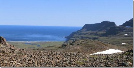 View to the north: a new sea and the Arctic Circle only 8 miles away.
That snow proved to be our undoing – we had planned to drop down into the
next valley and walk around the fjord at sea level back to the dinghy; however
the snow remaining in the pass was just too deep and too unsafe for us to take
this route without ice-axes or ropes at least. In addition the wind was getting
up and with a boat at anchor on a lee shore we reluctantly headed back the way
we had come (but not until we had nipped up the nearest summit for a look
north).
 360 degrees view
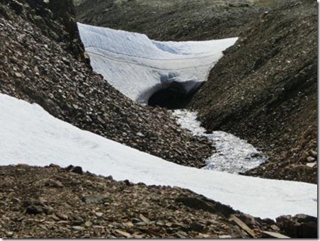 Some of the unstable snow bridges above a melt-water stream.
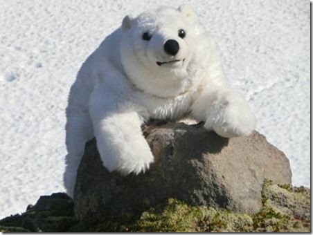 I don’t know what all the fuss is about. Care for a mint?
We made our way back to the dinghy and stopped on the foreshore to collect
mussels. At first we intended these to be for bait however we we realised how
many we had they changed into our starter for supper. As the SW wind had now
piped up we moved the boat from the lee shore (Peter and James doing a very
muddy but necessary job of hand hauling the kedge aboard) and sailed over to
Leirufjorður, anchoring here for the night. It is also uncharted, and reputedly
has a reef across the entrance, but we used a transit nosed out by the crew of a
boat called Black Velvet which sailed around here in 1997 and wrote it up for
the RCC. On this line we never had depths less than 4.9m.
We were more sheltered from the south-westerly wind here, and besides it
was another place to explore. Peter’s iPhone with the Navionics chart plotter
App proved itself more useful than the laptop chart plotter at this point and
Peter even uploaded an update for other users (we named the rock ‘Black
Velvet’). We passed a quiet night in this little bay and the fresh mussels in
white wine and garlic were just delicious.
(1) There will be a short pronunciation test on our return to the
UK |