Day 8...the sleigh ride continues
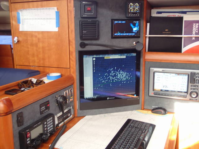
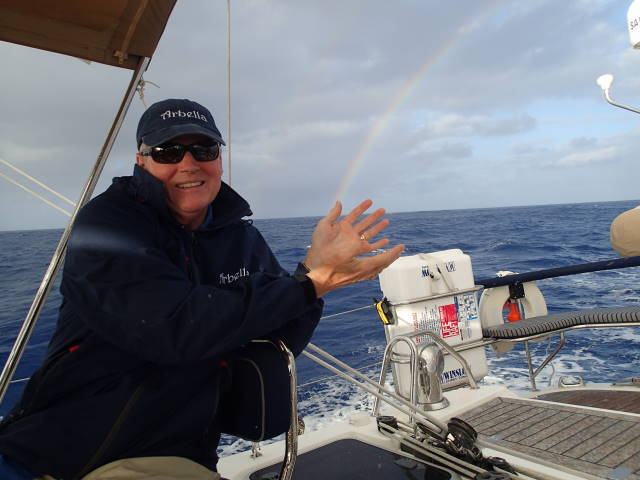
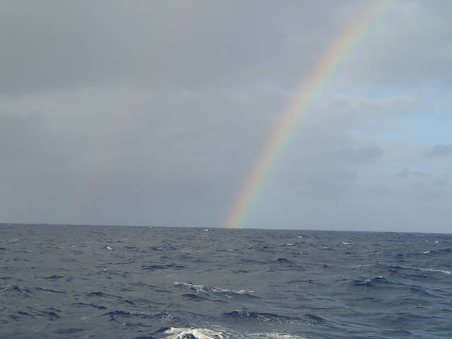
20:39.6N 42:11.4W Another 200+ mile day…213…we now have 8 consecutive 200+ miles days…a total of 1,659…we still have 22 knots of wind, out of the south, port tack, close hauled, 20-30 degree heel, making 9.2 knots through the water…we are tired of the angle, but we love the speed…so we will stick with “meals in a bowl”…Cap is disappointed that he cannot prepare one of his lavish meals…but what he does is still “magic” since the food has been very healthy and very delicious! Last night we “captured” some rainbow rays for his next gourmet creation (see photo)! NAVIGATION, COMMUNICATIONS, AND EMERGENCIES…a summary, as requested,…the pictures show some of this. We have 2 separate and redundant satellite communications systems for voice and data, including internet (and even Facetime sessions with family at the mid-Atlantic point)…our weariness is with the rolling and steep heel angles, making everything challenging…the old adage, “one hand for the boat”, says it all, since we constantly need one hand just to hold on…so all communications are difficult. We also have another satellite system for emergency email communication, and yet another for safety and security messages TO the boat (especially weather). Much of our communications is focused on information related to the weather…we get it several different ways. We also have VHF for line of site voice communications (about 20 miles), and Single Side Band for long distance communications (every day we connect in an organized way with about 12 other boats in the area, as we check positions, weather conditions, and conditions/problems aboard…very comforting to know other boats are not far…even though we have not seen a boat close for many days…we are all travelling at similar speeds since we are similar sized). Navigation is also very redundant….we have a topside system for navigation used by the watch team, and a separate computer based system below decks, called MaxSea which is our primary system for routing, weather analysis, and even animations showing how we would do going 10 days forward, given the specific weather predictions)…finally we have 3 separate handheld GPS units aboard…and yet, with all the electronics, just as is still done in the U.S. Navy today, we plot our course on a paper chart ….this assures that if ALL of our electronics fail, we still know where we were and can “dead reckon” to our destination. For Emergencies we have a life raft for 8 people attached to the rail, complete with food and water for 5 days….and we have a yellow grab bag that goes into the life raft with additional food and water for 8 people for 10 days, fishing line, flares, radio, and more….if we were to use the life raft, we also have several automatic devices that send messages to the U.S. Coast Guard, and others regarding our position and problem. Finally, we have medical gear….a “grab bag” in a yellow box for immediate use, a bigger yellow box with more serious equipment, and an AED defibrillator…and if that is not enough, we can call doctors associated with our gear who can direct our actions….we don’t intend to do any surgery out here…but we are equipped to handle whatever might come up (even though we did not sleep at a Holiday Inn last night!). We are fortunate to have a fully equipped boat, and well trained crew (everyone updated their First Aid and CPR training before the crossing)…because we are so prepared, we will not need anything…but that is always the best outcome! Tomorrow we will resume the ATLANTIC HISTORY…Lief Ericson, the Irish, Columbus, and Amerigo Vespuci….what are the facts!! Mike |